Retired Techie
Getting older, not necessarily wiser!
Getting older, not necessarily wiser!
Some of my personal graphical work, be it photos, ray tracing, structured drawings, or whatever.
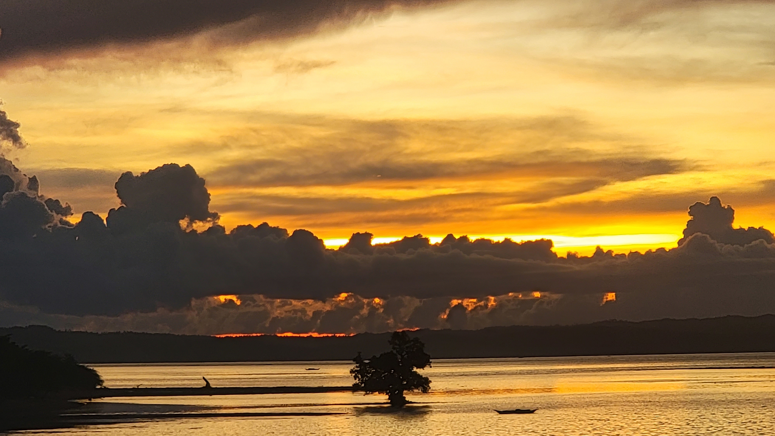
This picture was taken from a ferry just as it was tying up at Port Recondo on the island of Burias in the Philippines in June of 2022. Burias island is only reachable via ferry , as there is no airport. It is part of Bicol.
This picture is a JPEG, 2560 x 1440 pixels and 1 MB in size.
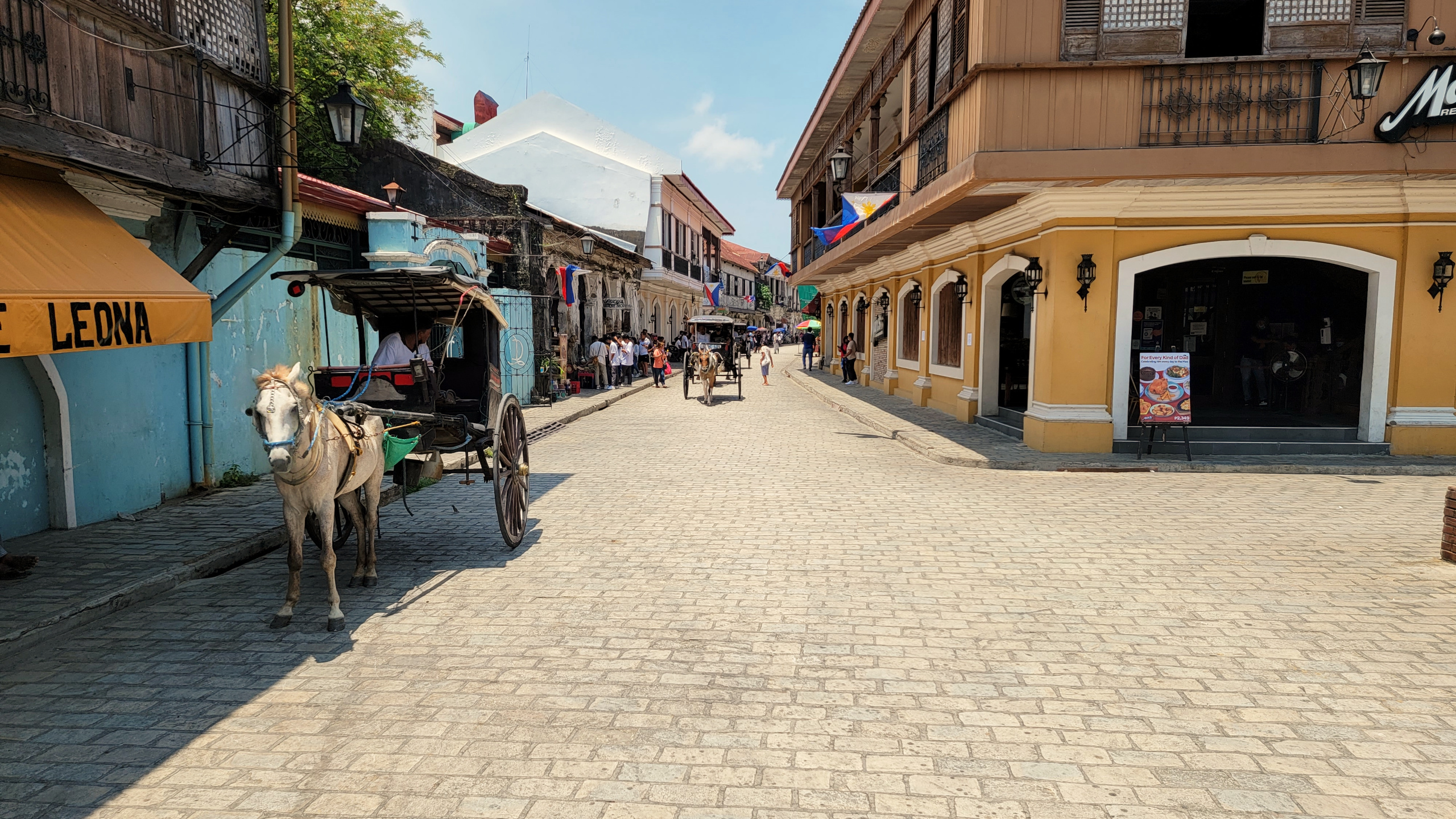
This picture is from downtown, in the City of Vigan, taken in 2022. Located on the West coast of Northern Luzon in the Philippines, it looks out on the South China Sea. The city is known for having a large number of preserved buildings built during the colonial period (Spanish design mixed with Philippine construction techniques). It is a UNESCO World Heritage site.
This picture is a JPEG, 2560 x 1440 pixels and 1.5 MB in size.
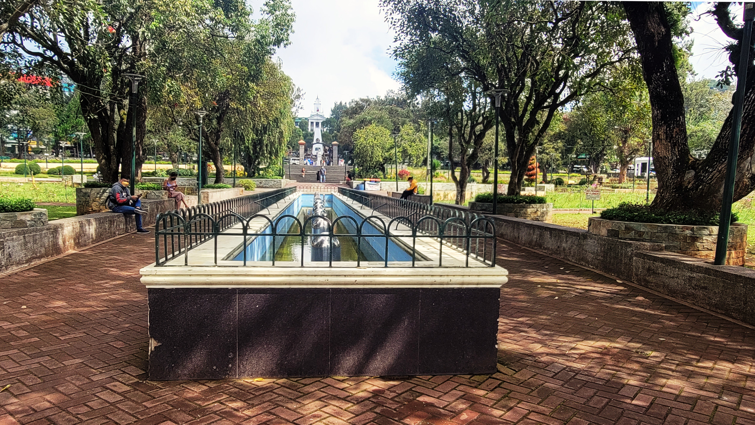
This picture was taken at Burnham Park in Baguio Philippines. It is looking across Rizal park towards Baguio City Hall. Baguio is up in the mountains, 4,600 feet above sea level. In addition to being highly urbanized, it is a popular vacation destination because of its comparatively cool temperatures.
This picture is a JPEG, 2560 x 1440 pixels and 1.5 MB in size.
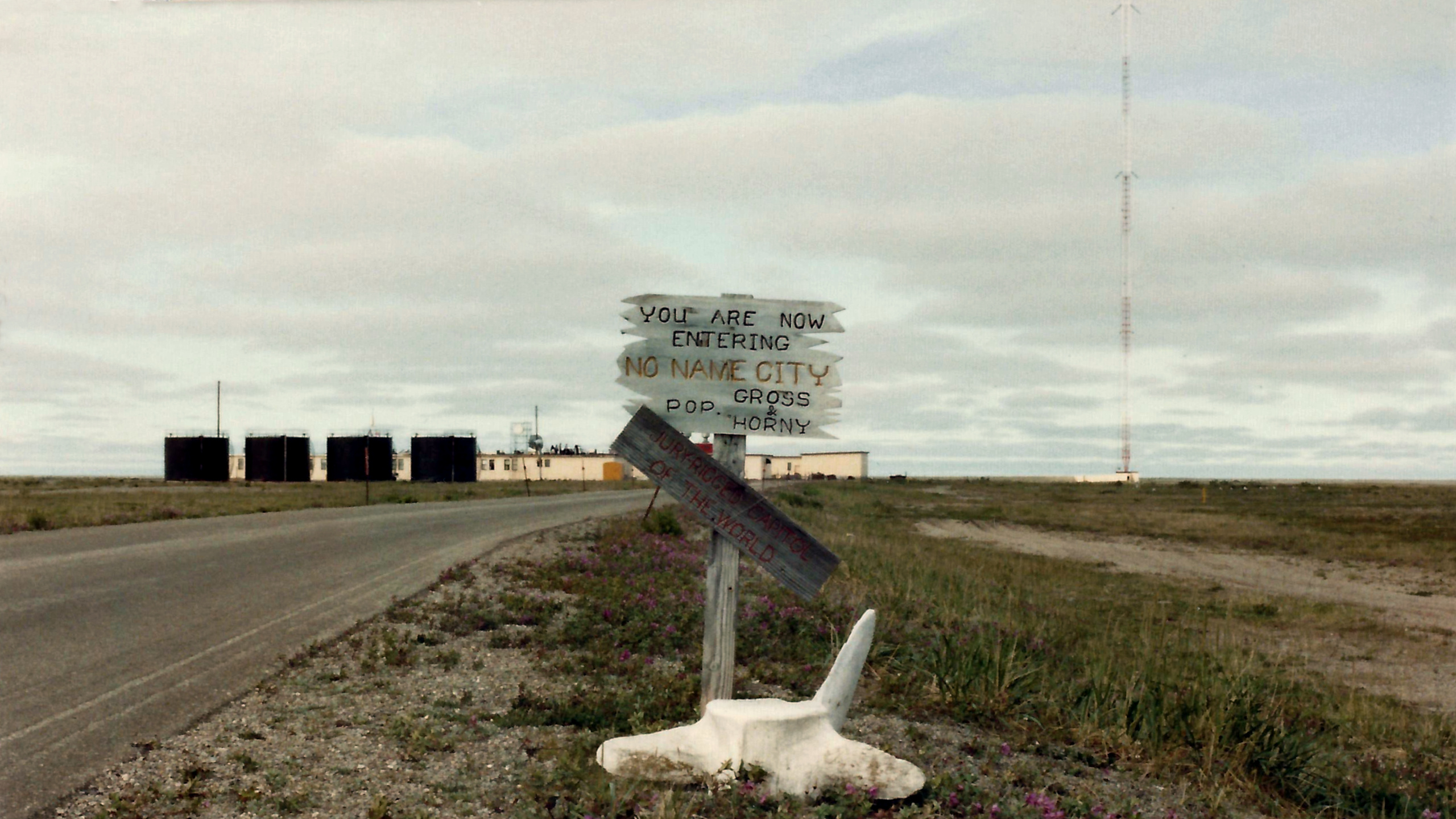
This picture was taken on the road leading to Coast Guard LORAN C (Long Range Aids to Navigation) Station Port Clarence Alaska back in the summer of 1983. Port Clarence is about 62 miles (100 KM) North North West of Nome Alaska, and about 60 miles south of the Arctic Circle. LORAN C was shut down by the US Coast Guard in 2010.
This picture is a JPEG, 2560 x 1440 pixels and 0.97 MB in size.
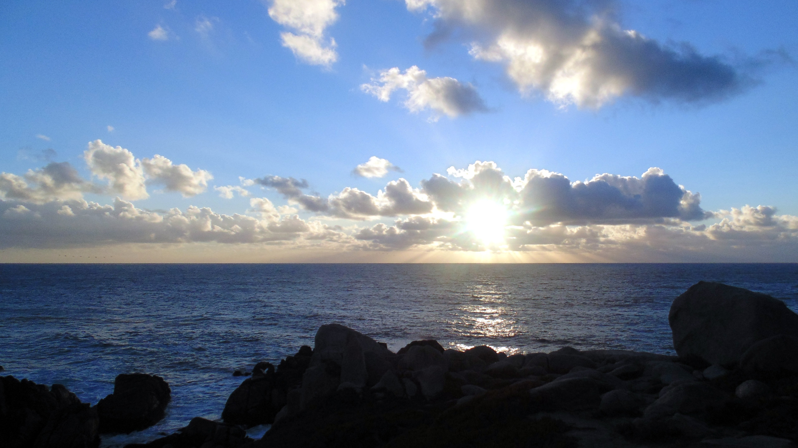
This is a picture of a Pacific Ocean sunset taken from Point Lobos California in December of 2016. Point Lobos is one of California’s State parks located just south of Monterey.
The image uploaded here is 16:9 ratio (2560 x 1440) jpeg and around 0.65 megabyte in size.